Boston (map) has advantages: train and bus terminals are in the city center, and Logan Airport is less than a 15-minute taxi or subway ride from the center.
Downtown Boston
Boston Common
At the foot of Beacon Hill, this is the heart of Boston—Boston's central park (map), where you can lie on the grass or stroll as you like. The Frog Pond is kids' favorite summer—for splashing—and winter—for skating.
Kids play (and parents photo) in the cooling waters of the Frog Pond wading pool on Boston Common on a hot summer day.
Park Street Station, at the Common's northeastern corner, is the heart of Boston's MBTA subway system. The most central hotels for sightseeing are around the Common.
Public Garden
Just west of Boston Common (map), the formal Public Garden is more refined. No lying on the grass here, but taking a short cruise in a swan boat or strolling and enjoying the seasonal flower beds are encouraged.
Swan boats cruise the Lagoon in the Public Garden.
The famous Swan Boats take you on a pedal-powered cruise around the Lagoon, street musicians hold forth on the Suspension Bridge, and a mounted General George Washington presides from his pedestal.
Beacon Hill
On the northwest side of Boston Common, Beacon Hill is crowned by the Massachusetts State House (capitol) and narrow colonial streets lined with charming 18th- and 19th-century houses.
The gold dome of the Massachusetts State House crowns Beacon Hill.
Downtown Crossing
The intersection of Winter, Summer and Washington streets (map) at the heart of Boston's department store and jewelry shopping district. It's easy to get there by subway to the Downtown Crossing station on the T's Red and Orange Lines.
Theater District
Just south of Boston Common, Boston's compact Theater District is packed with venues for plays, performances, comedy and entertainment of all types, as well as some good hotels.
Financial District
South of Government Center, east of Downtown Crossing, and south of Faneuil Hall Marketplace, skyscrapers tower above the Old State House, the British headquarters of Massachusetts Bay Colony, and later of the Commonwealth of Massachusetts.
The heart of the Financial District is Post Office Square, surrounded by Boston's most august financial institutions. Pretty Leventhal Park fills the center of the square, with a huge parking garage beneath.
Chinatown
A few blocks south of Downtown Crossing, near South Station and the Financial District, packed into the area around Beach Street, Tyler Street, and Harrison Avenue (map), are a dozen Chinese restaurants, groceries, and shops.
Many Bostonians make the pilgrimage to Chinatown on Sunday to dine on dim sum, the seemingly endless succession of little delicacies served from carts circulating through the large dining room.
South Boston
Southeast of the Financial District across Fort Point Channel, South Boston has two distinct areas:
In South Boston's Seaport District you'll find the Boston Convention & Exhibition Center, Seaport World Trade Center, Flynn Cruiseport Boston, and a number of good hotels.
Boston Convention & Exhibition Center (BCEC)
The Boston Convention & Exhibition Center (BCEC, BEE-see-EE-see), 415 Summer Street in Boston's Seaport District, (map), is Boston's largest meeting, convention and exhibition facility, just east across Fort Point Channel from the historic city center and just west of Boston-Logan International Airport via the Ted Williams Tunnel.
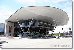
Boston Convention & Exhibition Center (BCEC).
"Southie"
South and east of the Seaport District is the center of South Boston, known as "Southie," traditionally Boston's Irish bastion. Southie offers a long stretch of parks and sea beaches stretching for miles from Castle Island Park east and south all the way to the John F Kennedy Museum and Presidential Library, and University of Massachusetts-Boston campus.
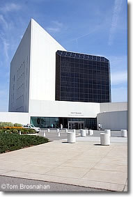
John F Kennedy Library, South Boston.
Note that South Boston is not Boston's South End, an entirely different residential district just south of Back Bay.
Boston Waterfront
East of Faneuil Hall Marketplace and south of the North End is Boston's Waterfront. The solid old brick and granite buildings which once served as warehouses for India and China traders have been modernized and converted to offices, shops, restaurants and apartments.
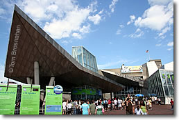
New England Aquarium, Boston Waterfront.
The New England Aquarium, Marriott Long Wharf Hotel and Boston Harbor Hotelare at the southern end of the Waterfront, and other hotels are available for your enjoyment. Harborwalk allows you to walk along the waterfront for miles.
Government Center
Boston City Hall, state and federal offices are surrounded by Beacon Hill, the Financial District, Faneuil Hall Marketplace, and Haymarket Square. Centerpiece of the complex is Boston City Hall (1968), a modern fortress-like structure in the "brutalist" style that is as true to Boston's cultural and architectural traditions as a dumpster.
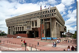
Boston City Hall in Government Center.
You'll probably see Government Center on your way to neighboring Faneuil Hall Marketplace, a triumph of historic preservation as urban renewal, thronged daily with people who like being there.
Faneuil Hall Marketplace
Boston's historic Faneuil Hall and Quincy Market complex has shops, takeout food stalls, cafés, good hotels, taverns and boutiques.
Faneuil Hall
Known as "The Cradle of Liberty" because of citizens' meetings were held here before and during the American Revolution, Faneuil Hall is now part of the Boston National Historical Park.
Haymarket
Boston's big open-air food market still takes place here between Faneuil Hall Marketplace, Government Center and the North End every Friday and Saturday. The market is centered on short, narrow Blackstone Street (map). Most of the costermongers (vendors) are oldtimers from the North End's Italian community.
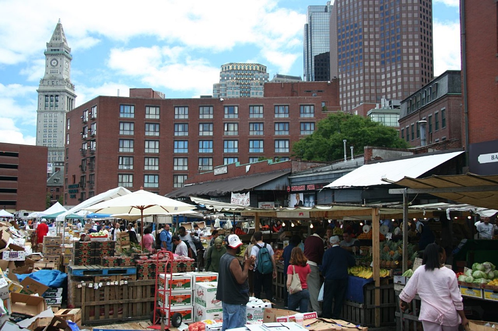
Haymarket open-air market.
While you're here, have a look at the Union Oyster House at 41 Union Street. Established in 1826, it's said to be "America's oldest restaurant."
TD Garden & North Station
The NBA's Boston Celtics basketball team and NHL's Boston Bruins ice hockey team pursue their victories in the 19,580-seat TD Garden arena at 100 Legends Way, above North Station, less than a mile north of Boston Common.
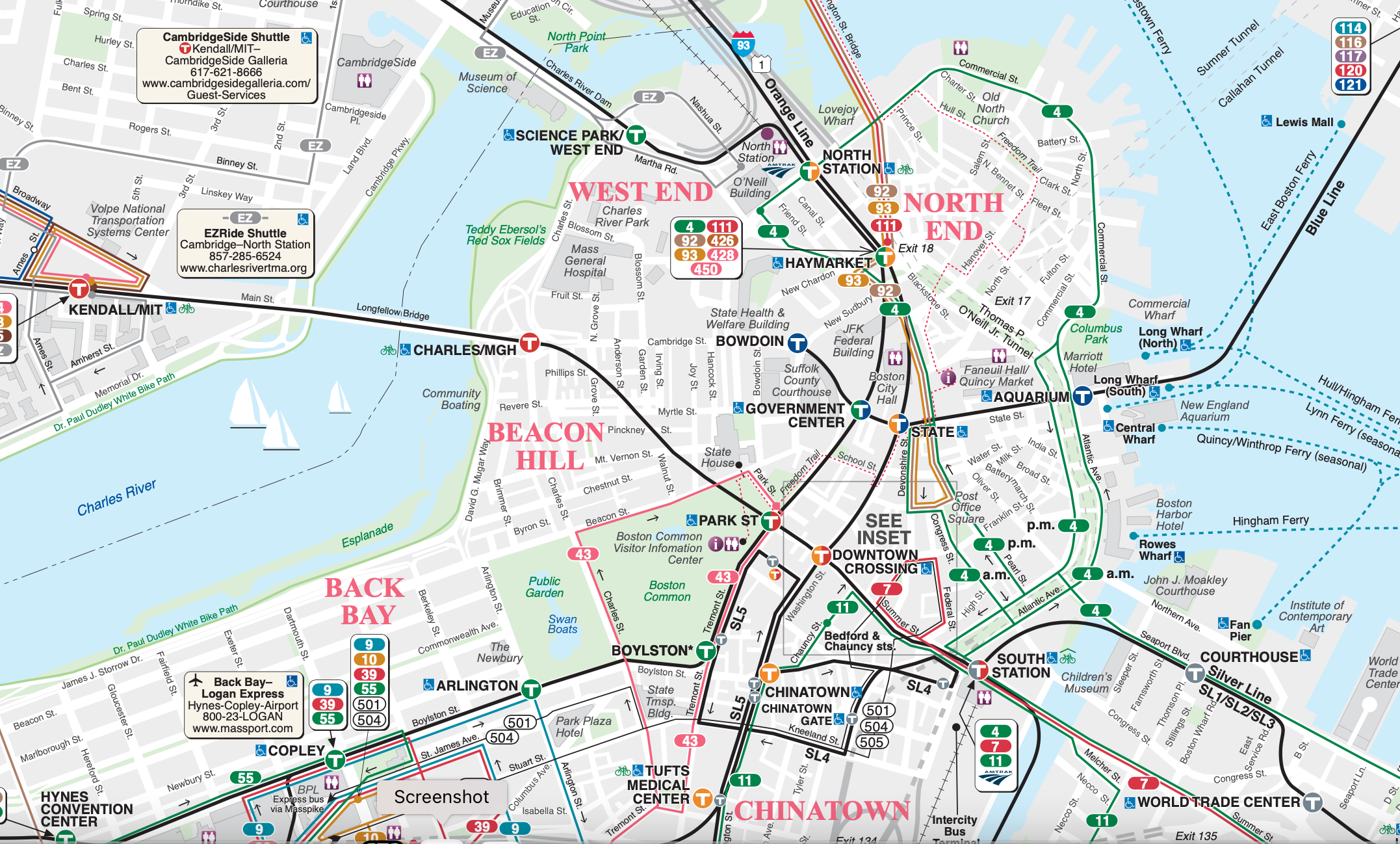
Public transit lines in downtown Boston. Click on the map for the full PDF version.
It's easily reached by MBTA Green and Orange Line subway trains, and by MBTA Commuter Rail trains on lines north and west of Boston, as well as Amtrak Downeaster trains to and from Portland, Maine.
North End
Home to successive waves of immigrants (most recently Italians), this is where you'll find Old North Church, Paul Revere's house, and numerous good Italian restaurants, cafés and pastry shops. Come to the North End to visit the historic landmarks, stop in for an espresso and a cannolli at one of the cafes or pastry shops, or even stay for lunch or dinner.
Charlestown
North of the tip of the Boston peninsula, across the Charles River, is the mostly-residential district of Boston called Charlestown (map).
Landmarks: look for the Bunker Hill Monument at its highest point, and on the riverbank in the Charlestown Navy Yard (also called the Boston Naval Shipyard), the tall 18th-century masts of the USS Constitution ("Old Ironsides").
The USS Constitution ("Old Ironsides") and the Bunker Hill Monument, in Charlestown.
Back Bay
Developed on filled land during the 19th century and now one of the city's most important residential, business, entertainment and shopping districts, it includes Copley Square, Copley Place shopping complex, the Prudential Center ("the Pru"), Hynes Convention Center, and Newbury Street.
A summer concert at the Hatch Shell on the Charles River Esplanade.
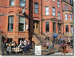
La Voile, a French restaurant on Newbury Street in Back Bay, Boston MA.
Back Bay's main east-west residential axis is Commonwealth Avenue (map; see below).
Charles River Esplanade
The Charles River Esplanade (map) is the river's edge of Beacon Hill, on the north side. With its marina, the Hatch Memorial Shell for summer concerts, a bikepath, and lots of benches, it is the loveliest part of the Charles's banks.
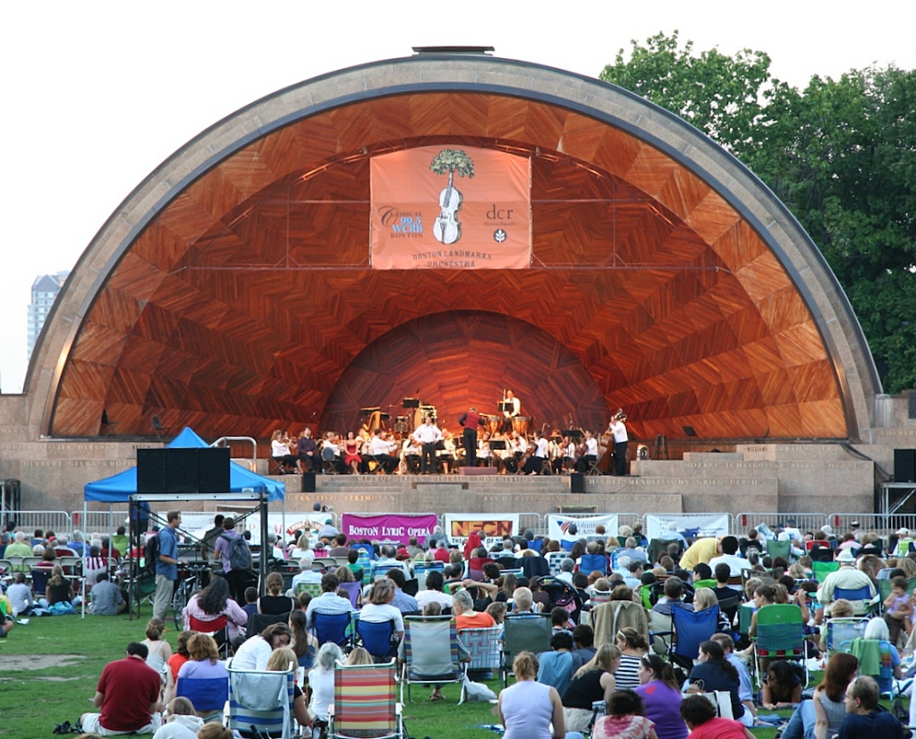
A summer concert at the Hatch Shell on the Esplanade.
Commonwealth Avenue
The wide, tree-lined monumental boulevard starting at the Public Garden is the main thoroughfare of the Back Bay. It goes west to Kenmore Square.
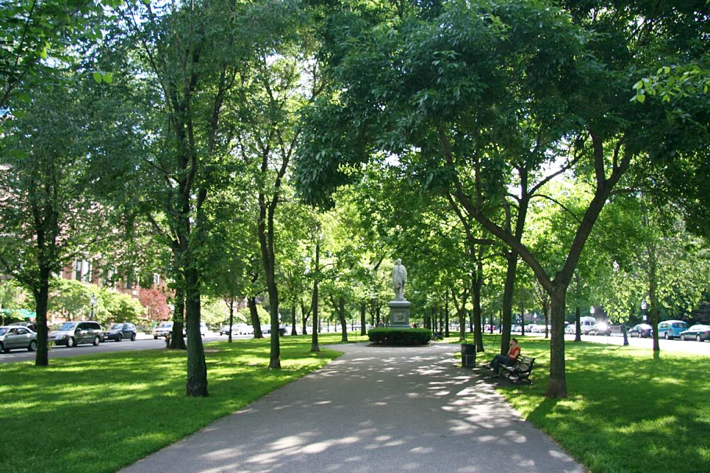
Boston's only boulevard in the grand European style, it is a beautiful link, through the Back Bay, in Frederick Law Olmsted's Emerald Necklace of Boston parks and gardens.
Newbury Street
Starting at the Public Garden by the deluxe Taj Hotel and extending westward through Boston's Back Bay (map), Newbury Street is where you find local boutiques, art galleries, bistrots and cafés sharing space with graceful old residential stone-and-brick townhouses,
Copley Square
Copley Square (map), at the corner of Boylston St and Dartmouth St, is framed by the classic Boston Public Library, the elegant Fairmont Copley Plaza Hotel, and Henry Hobson Richardson's famous Trinity Church, built in the late 1800s.
Henry Hobson Richardson's Trinity Church in Copley Square.
Modern intruders on this gentility are the striking mirror-glass shaft of the John Hancock Tower and, a block west, the sprawling office-and-shopping complex called Copley Place.
Prudential Center
Prudential Center, 800 Boulston Street, bounded by Huntington Avenue and Dalton Street, is built above the Massachusetts Turnpike (I-90), an office tower, hotel and shopping complex near the Hynes Convention Center (map).
South End
Not to be confused with South Boston, the South End is mostly residential, with harmonious five-story red brick buildings in a variety of architectural styles including Second Empire, Italianate and Renaissance Revival.
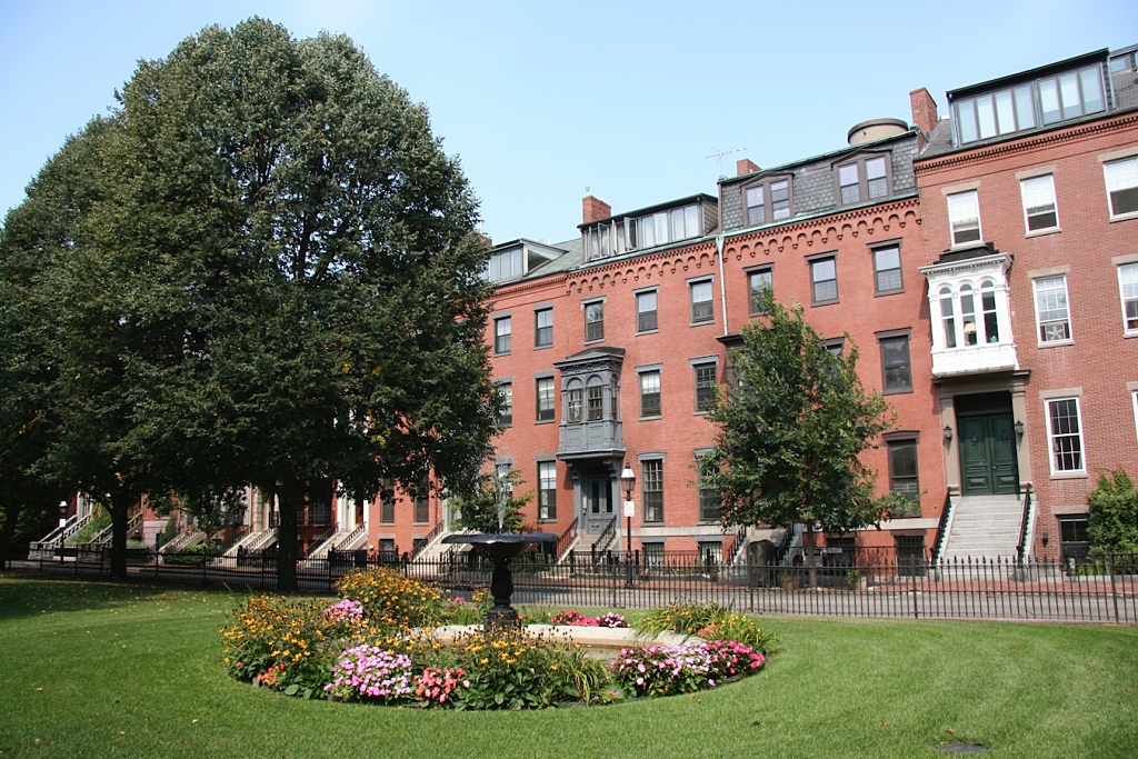
Private park in Boston's South End neighborhood.
It's known for good restaurants, cafés and bars. Blackstone Square and Franklin Square are shady refuges on the north and south sides of Washington Street at W Newton Street.
Huntington Avenue
Nicknamed Avenue of the Arts, the avenue passes the Christian Science Church Center, Symphony Hall, Northeastern University, and the Museum of Fine Arts, with the Isabella Stuart Gardner Museum just off the avenue.
Christian Science Plaza
Known for its reflecting pool, the Mother Church of the Christian Science faith is well worth a visit, as its Mapparium, and elegant Reading Room.
Symphony Hall
Home of the Boston Symphony Orchestra, Symphony Hall, 301 Massachusetts Avenue at Huntington Avenue, also hosts many other headline musical performances.
New England Conservatory
The New England Conservatory at 290 Huntington Avenue offers many performances by students, faculty and visiting artists.
Northeastern University
Known for its programs in experiential education (learn-by-doing), Northeastern has a prime location among Boston's arts institutions at 360 Huntington Avenue.
Museum of Fine Arts
Boston's largest and most renowned collection of paintings, sculpture and historic art objects, the "MFA's" campus is a landmark at 465 Huntington Avenue.
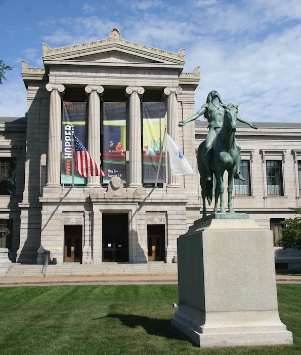
Museum of Fine Arts on Huntington Avenue.
Isabella Stewart Gardner Museum
Though located a few blocks off Huntington Avenue, the Gardner is easily visited in combination with a visit to the Museum of Fine Arts.
Massachusetts College of Art & Design
Among Boston's most prominent art schools, 150-year-old MassArt at 621 Huntington Avenue has its exhibits, tours and talks as well as its courses.
Kenmore Square
Boston University is a few blocks west, smaller colleges are closer, so Kenmore has good hotels, cafés, bookstores, cinemas, and clubs.
Kenmore Square is a Boston landmark at the western end of Commonwealth Avenue's parklike extent. (Comm Ave continues westward, but without the trees that make it part of the Emerald Necklace.)
On the Boston skyline at night, you can always locate Kenmore Square by the huge red Citgo delta sign.
With Boston University just to the west, Kenmore is enlivened by students and professors who flock to its cafés, bookstores, movies, and clubs.
Fenway Park, home of the Boston Red Sox baseball team, is just to the south of the square, which you can readily realize on any summer night when there's a game being played: you'll see the lights and hear the noise.
Here are hotels near Fenway Park.
To get to Kenmore Square by subway, take any Green Line B (Boston College), C (Cleveland Circle) or D Riverside) train to the Kenmore station.
Back Bay Fens
The Back Bay Fens sound uninviting, but actually this unappetizing name designates a pretty park that is an important link in Frederick Law Olmsted's Emerald Necklace, a chain of green parks, copses, and waterways for the residential districts of Boston from the Boston Common and Public Garden, through the Back Bay and Roxbury to the Arnold Arboretum in Jamaica Plain (map).
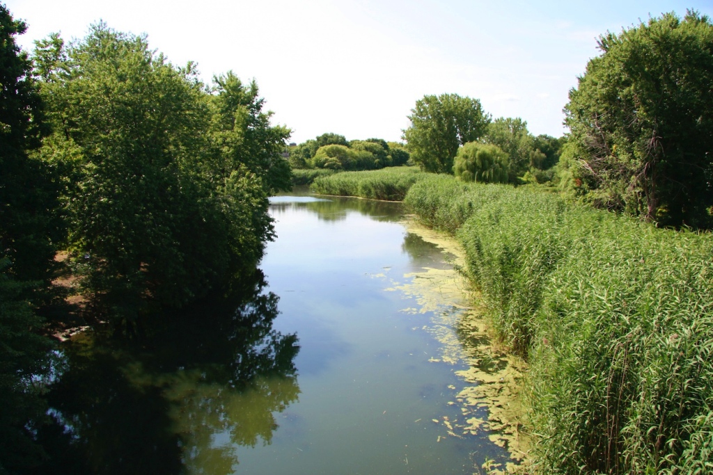
The Back Bay Fens, a link in Olmsted's Emerald Necklace.
Roxbury
Once an incorporated city in its own right, historic Roxbury is now the center of African-American culture following the migration of people from the southern states during the 1940s and 1950s, joined later by immigrants from the Caribbean.
The 527-acre (213-hectare) Franklin Park, Boston's largest, is in Roxbury, the final "link" in Frederick Law Olmsted's Emerald Necklace of parks and shaded avenues extending from Boston Common through the city.
Around Boston
East Boston
Home to Logan Airport, this district northeast of Charlestown, is reached by three tunnels: Callahan Tunnel north, Sumner Tunnel south, and Ted Williams Tunnel (both directions).
Cambridge
Across the Charles River is the separate City of Cambridge MA, with its world-famous universities: Harvard and the Massachusetts Institute of Technology, plus its own selection of good hotels. More...
Brookline
A mostly residential city known for its gracious old houses and estates, Brookline boasts a number of distinguished residents and former residents, including architect Henry Hobson Richardson, landscape architect Frederick Law Olmsted, President John Kennedy and other members of his family, and Boston Symphony Orchestra conductor Serge Koussevitsky and Boston Pops conductor Arthur Fiedler.
Brookline is also full of doctors and other medical personnel, as the Longwood Medical Area extends from Boston into Brookline along Longwood Avenue.
Somerville
Mostly residential, Somerville, north of Cambridge, is a mostly working-class city that is also home to many university students, some attending universities and colleges in Cambridge, others enrolled at Tufts University, the campus of which is partly in Somerville and partly in Medford MA.
Out of Boston
You can use Boston as your base for day-trips and overnight excursions to nearby towns such as Concord, Gloucester, Ipswich, Lexington, Plymouth, Quincy, Rockport, Salem, and even Cape Cod. All are accessible by MBTA Commuter Rail train, MBTA Greater Boston bus, or intercity bus. More...
